Transcontinental Monsoon Dynamics: India South Korea Rain Cloud Analysis for 2026
- Jul 23
- 4 min read
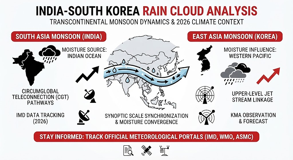
The intricacies of global atmospheric circulation continue to capture the attention of meteorologists and climate scientists worldwide. Among the most fascinating recent meteorological phenomena is the observation of sweeping atmospheric anomalies and massive cloud formations linking distant geographic regions. In particular, modern satellite data and synoptic monitoring have focused scientific discourse on large-scale moisture convergence zones, prompting a detailed India South Korea rain cloud analysis to understand how interconnected Asian weather systems behave during dynamic monsoon phases.
This comprehensive article explores the science behind transcontinental weather patterns, teleconnections linking South Asia and East Asia, current 2026 climate dynamics, and the broader implications for regional agriculture and water security.
The Science of Mega-Scale Cloud Bands and Monsoonal Convergence
To understand how extensive cloud systems can stretch across thousands of kilometers—bridging South Asia through parts of China all the way to the Korean Peninsula—we must examine the mechanics of the Monsoon Convergence Zone.
During the peak summer monsoon period, moisture-laden winds originating from the Indian Ocean interact with regional sub-tropical systems. When low-pressure anomalies align with upper-level jet streams, they can create continuous pathways of moisture transport. This phenomenon is often supported by atmospheric wave trains known as the Circumglobal Teleconnection (CGT).
Key Drivers of Transcontinental Weather Linkages
Moisture Transport Channels: Southerly wind anomalies over the tropical Indian Ocean transport vast amounts of water vapor northward, feeding continuous cloud bands.
Upper-Level Jet Stream Dynamics: Monsoon heating triggers upper-tropospheric Rossby wave trains that propagate along westerly jet streams, bridging South Asian and East Asian climate variability.
Synoptic Scale Synchronization: While local topography dictates immediate downpours, macro-scale satellite observations frequently highlight how regional convergence can temporarily synchronize heavy precipitation events across multiple Asian sub-continents.
Teleconnections: Connecting South Asian and East Asian Monsoons
Climate researchers have long studied the statistical and physical teleconnections linking Indian summer monsoon variability with the Changma or summer monsoon over the Korean Peninsula. Singular Value Decomposition (SVD) and correlation analyses of historical data reveal profound interactions between these two major climatic subsystems.
The Role of Atmospheric Wave Trains
When the Indian subcontinent experiences intense surface heating and robust convective activity, it generates planetary-scale atmospheric waves. These waves travel eastward along the mid-latitude westerlies, directly influencing pressure systems over East Asia.
Pressure Anomalies: The resulting wave trains can foster anticyclonic or cyclonic anomalies over Northeast Asia, modulating the local moisture supply available for cloud development over Korea.
Precipitation Feedback: Consequently, exceptional moisture pulses and active phases in the Indian monsoon theater often correlate with shifts in the behavior of East Asian rain bands, emphasizing that regional weather is never entirely isolated.
2026 Climate Context: Navigating Variability and Regional Deficits
The year 2026 has presented a complex climate canvas across Asia. Regional meteorological agencies, including the India Meteorological Department (IMD) and international bodies like the World Meteorological Organization (WMO), have closely monitored shifting ENSO (El Niño-Southern Oscillation) states and Indian Ocean Dipole (IOD) phases.
Key Observations in the 2026 Monsoon Landscape
Transitioning Ocean States: Weak La Niña-like conditions transitioned toward ENSO-neutral states, with subsequent models anticipating the development of El Niño influences during the broader seasonal cycle.
Precipitation Rebound Phases: Despite initial dry spells or localized deficits early in the season across parts of South Asia, active monsoon surges and mega-scale convergence events have periodically delivered intensive bursts of rainfall, helping bridge precipitation gaps and replenish vital reservoirs.
Agricultural and Hydrological Impacts: Timely cloud bursts and active moisture bands are critical for supporting the kharif crop sowing season and stabilizing regional water tables.
Comparative Overview of Monsoonal Teleconnection Factors
Factor / Parameter | South Asian Monsoon Influence | East Asian / Korean Monsoon Linkage |
Primary Moisture Source | Indian Ocean and Arabian Sea / Bay of Bengal | Western Pacific and East China Sea convergence |
Connecting Mechanism | Circumglobal Teleconnection (CGT) wave trains | Upper-tropospheric westerly jet stream interactions |
Observational Tracking | Satellite imagery, synoptic charts, and LPA benchmarks | Regional radar networks, satellite cloud-band tracking |
Comprehensive India South Korea Rain Cloud Analysis
A dedicated India South Korea rain cloud analysis reveals that mega-cloud formations are manifestations of macro-scale atmospheric rivers and extended convergence lines. Rather than isolated local storms, these massive bands underscore the unified nature of the Asian summer monsoon system. When cross-border moisture corridors open up, countries along the path experience synchronized atmospheric turbulence, high-volume precipitation, and sudden transitions from dry spells to flood alerts. Understanding these pathways is essential for improving medium-range weather forecasting and disaster mitigation models.
Frequently Asked Questions (FAQ)
Q: What does an India South Korea rain cloud analysis typically examine?
A: An India South Korea rain cloud analysis investigates macro-scale moisture convergence zones, atmospheric wave trains, and teleconnection patterns that link weather systems across South and East Asia.
Q: Are weather events in India and South Korea directly connected physically?
A: Yes, through planetary-scale dynamics such as the Circumglobal Teleconnection (CGT) and upper-tropospheric Rossby wave trains driven by Asian monsoon heating, climate variability in South Asia can influence pressure systems and precipitation patterns in East Asia.
Q: How do meteorologists track these massive transcontinental cloud systems?
A: Meteorologists utilize advanced geostationary satellite imagery, multi-model ensemble (MME) climate tracking, and upper-air sounding data to monitor moisture transport channels and pressure anomalies across thousands of kilometers.
Q: Why are these large-scale climate studies important for agriculture?
A: Understanding broad teleconnections and rain cloud behavior helps national meteorological services provide better long-range forecasts, enabling farmers and water management authorities to prepare for droughts, heavy floods, and shifting crop cycles.
Stay Informed and Track Official Weather Portals
To monitor real-time satellite imagery, seasonal forecasts, and official meteorological updates, utilize these verified portals:
Explore Regional Forecasts on the India Meteorological Department (IMD) Website – Access official long-range monsoon outlooks, press releases, and daily weather reports.
Check Global Climate Insights via the World Meteorological Organization (WMO) – Read international bulletins regarding seasonal climate outlooks and regional weather hazards.
Review ASEAN Specialized Meteorological Centre (ASMC) Outlooks – Track regional climate predictions, seasonal wind flows, and precipitation tercile summaries.


Comments