Project Tiger at 50+: How Wildlife Census Technology in India Secures Big Cats
- 11 hours ago
- 7 min read
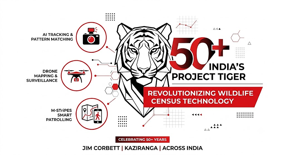
When India launched Project Tiger in 1973 at Jim Corbett National Park, fewer than 1,800 Bengal tigers survived in the wild. Ravaged by decades of unmonitored hunting, habitat fragmentation, and aggressive poaching, Asia’s apex predator was teetering on the brink of extinction. Fast forward to 2026, and India stands as the undisputed global citadel for tiger conservation. Housing over 75% of the world's wild tiger population across 58 designated tiger reserves, India’s tiger count has rebounded to over 3,682 individuals according to the latest quadrennial national assessment cycles.
This monumental recovery is not merely a triumph of habitat protection and legal enforcement; it is a testament to an unprecedented technological revolution. Over the past decade, wildlife management in India has fundamentally transformed. The days of manual foot tracking and subjective estimates are long gone. Today, the integration of artificial intelligence (AI), unmanned aerial vehicles (drones), high-resolution geospatial mapping, and GPS-enabled smart patrolling has placed India at the international apex of ecological monitoring.
As Project Tiger moves past its golden jubilee milestone, the deployment of wildlife census technology in India is rewriting the rules of biodiversity protection. From the dense, riverine grasslands of Kaziranga National Park to the rugged foothills of Jim Corbett, modern technology is enabling real-time threat mitigation, precise individual tiger identification, and non-invasive population modeling.
The Paradigm Shift: From Pugmark Counts to Digital Precision
To understand the magnitude of today’s technological revolution, one must examine the humble origins of wildlife monitoring in India. For decades, forest departments relied heavily on the traditional Pugmark Tracking Technique. Field staff manually lifted footprints using plaster casts or glass tracings, attempting to differentiate individual tigers based on paw size and shape. However, this method was inherently flawed: soil texture, slope, weather, and human bias frequently led to double-counting or severe underestimation.
In the mid-2000s, the National Tiger Conservation Authority (NTCA), in partnership with the Wildlife Institute of India (WII), overhauled the national monitoring framework. They instituted the All India Tiger Estimation (AITE) protocol, replacing guesswork with scientific rigour.
The modern census operates on a multi-tiered framework combining:
Ground-level ecological data collection covering hundreds of thousands of square kilometres.
Double-sampling methodologies using Spatial Capture-Recapture (SECR) models.
Extensive camera-trap grids deployed across critical tiger habitats.
In the latest census exercise, over 32,000 camera traps were deployed across India’s forests, generating more than 35 million wildlife photographs. Processing this vast sea of visual data manually would take years. This operational bottleneck spurred the introduction of advanced artificial intelligence and machine learning algorithms.
Pillar 1: AI Tracking and Computer Vision in Tiger Identification
Every Bengal tiger possesses a unique arrangement of black stripes on its golden coat—a natural fingerprint that remains constant throughout its life. Leveraging this unique biology, computer vision has become the backbone of modern population estimation.
Raw Camera Trap Images (Millions of Photos)
                  │
                  ▼
   AI Sorting Engine (Filter Non-Target / Empty Frames)
                  │
                  ▼
  Pattern Recognition Algorithm (Extract Unique Stripe Fingerprint)
                  │
                  ▼
 CaTRAT Matching System (Cross-Reference National Tiger Database)
                  │
                  ▼
 Verified Individual Profile (Age, Sex, Location & Range Map)
Automated Image Sorting & Pattern Matching
In earlier census cycles, wildlife biologists spent countless hours sorting through camera trap photos containing moving branches, cattle, or non-target species. Today, deep-learning algorithms automatically filter out empty frames and classify species with over 98% accuracy.
Once a tiger is detected, specialized software like CaTRAT (Camera Trap Data Repository and Analysis Tool) extracts the stripe patterns along the flank and face. By converting these visual patterns into mathematical coordinates, the software instantly compares new photographs against a national repository containing tens of thousands of known tiger profiles.
Benefits of AI-Driven Identification
Elimination of Human Error: AI algorithms reduce human bias and eliminate duplicate entries across adjacent forest divisions.
Real-time Tracking of Corridors: When a tiger moves from Jim Corbett National Park through agricultural corridors into neighboring sanctuaries, AI vision systems recognize the individual across different camera grids, mapping critical wildlife corridors.
Health & Demographics Monitoring: Machine learning models are now trained to detect physical injuries, pregnancy, skin lesions, and body condition scores, allowing managers to intervene before health crises escalate.
Pillar 2: Drone Mapping & Thermal Surveillance in Jim Corbett and Kaziranga
Terrain constraints have historically hampered effective wildlife censuses. The impassable elephant grass of Assam’s floodplains and the steep, ravined forests of the Himalayan foothills present massive logistical hurdles. To conquer these landscape barriers, forest managers have taken to the skies with advanced drone technology.
Kaziranga National Park: Taming the Floodplains
Kaziranga, a UNESCO World Heritage site situated along the Brahmaputra River, is famous for housing the world’s largest population of the one-horned rhinoceros alongside one of the highest densities of wild tigers. However, annual monsoon floods inundate up to 70% of the park, forcing animals to migrate toward the higher grounds of the Karbi Anglong hills.
During these critical periods, customized thermal-imaging drones perform aerial reconnaissance:
Nighttime Thermal Mapping: Equipped with long-wave infrared (LWIR) sensors, drones detect thermal signatures through dense canopy layers, spotting hidden tigers, rhinos, and poachers in total darkness.
Habitat Dynamics & Inundation Modeling: High-resolution orthomosaic drone maps allow park managers to track changing vegetation cover, channel erosion, and floodwater progression in real time, aiding both census planning and emergency rescue operations.
Jim Corbett National Park: Navigating the Terai Shivaliks
In Uttarakhand’s Jim Corbett National Park—the landscape with the highest tiger density in India—dense sal forests and rugged terrain make physical ground coverage challenging.
Corbett’s anti-poaching units utilize fixed-wing surveillance drones paired with vertical take-off and landing (VTOL) systems:
Canopy-Penetrating Sensors: Drones map terrain elevational profiles and create 3D digital surface models (DSMs) of tiger movement zones.
Corridor Monitoring: Drones patrol linear infrastructure boundaries, such as highways and railway tracks cutting through the Rajaji-Corbett tiger corridor, detecting human encroachments and illegal timber logging before animals are disturbed.
Pillar 3: Smart Patrolling via M-STrIPES
Technology is only as effective as the boots on the ground. To empower frontline forest guards, the NTCA and WII developed M-STrIPES (Monitoring System for Tigers: Intensive Protection and Ecological Status). This integrated software suite has transformed traditional foot patrols into data-driven tactical operations.
Feature Component | Core Functionality | Impact on Census & Conservation |
Mobile Patrol Module | Tracks guard patrol routes in real time via smartphone GPS. | Ensures comprehensive spatial coverage of remote forest beats. |
Incident Logging | Geotags direct sightings, scats, pugmarks, and snare locations. | Builds a central database for spatial crime and sign analysis. |
Ecological Module | Records prey species abundance, human disturbance, and habitat status. | Computes precise prey-to-predator ratios essential for carrying capacity. |
Offline Synchronization | Operates without active cellular service; syncs once connected to base camp. | Enables continuous monitoring deep inside core tiger reserves. |
Through M-STrIPES, forest guards do not just patrol; they actively gather standardized ecological data. When a guard encounters a tiger pugmark or scat sample in Corbett or Kaziranga, the exact coordinates, time stamp, and accompanying photo are instantly uploaded to the central database. Managers can access web dashboards to visualize patrol gaps, high-risk poaching zones, and tiger hotspot clusters, enabling optimal resource allocation.
The 2026 Conservation Horizon: Emerging Frontiers
As India consolidates its success under Project Tiger, new technological frontiers are being integrated into national park management. The focus is expanding beyond simple population counting toward holistic ecosystem health and predictive threat management.
1. Acoustic Monitoring & Bio-Acoustics
Low-cost autonomous recording units (ARUs) are being deployed across core habitats to capture forest soundscapes. AI audio processing models analyze these continuous recordings to isolate:
Distress calls of prey species like spotted deer and sambar.
Territorial tiger roars.
Illegal gunshots, chainsaw noise, or vehicular intrusion kilometers away, triggering rapid-response units.
2. Satellite Remote Sensing & Environmental DNA (eDNA)
High-resolution satellite imagery from ISRO and international constellations tracks land-use changes, forest canopy density, and water body availability across changing seasons. Simultaneously, researchers are pioneering the use of eDNA analysis. By collecting water samples from forest streams or waterholes, scientists can sequence micro-traces of shed skin, hair, and saliva, confirming the presence of tigers and co-predators without ever physically spotting them.
3. Global Leadership: Exporting Indian Tech via IBCA
Recognizing India’s unmatched expertise, Prime Minister Narendra Modi launched the International Big Cat Alliance (IBCA). India is now sharing its proprietary software platforms, training modules, and drone patrolling methodologies with range countries across Southeast Asia, Central Asia, and Africa. The software frameworks built for Project Tiger are now protecting jaguar, snow leopard, and cheetah populations globally.
Frequently Asked Questions (FAQ)
What is the current tiger population in India?
As of the latest official national estimates, India is home to over 3,682 wild tigers, representing approximately 75% of the total global wild tiger population. This population is spread across 58 designated tiger reserves across five major ecological landscapes.
How has wildlife census technology in India improved tiger population accuracy?
Modern wildlife census technology in India has eliminated the errors of manual footprint tracking by combining AI pattern-recognition software (CaTRAT), high-density camera trap grids, drone mapping, and double-sampling SECR statistical models. This ensures every counted tiger is uniquely identified by its stripe signature, preventing double-counting across reserves.
How do thermal drones help in national parks like Kaziranga and Jim Corbett?
Thermal drones use long-wave infrared sensors to detect heat signatures through dense forest canopy and tall elephant grass. In Kaziranga, they assist during monsoon floods to locate stranded wildlife and track poachers. In Jim Corbett, drones map rugged terrain, monitor wildlife corridors, and safeguard park perimeters against human encroachment.
What is M-STrIPES and how does it work?
M-STrIPES (Monitoring System for Tigers: Intensive Protection and Ecological Status) is a mobile and desktop software suite used across India's tiger reserves. It records forest guard patrol tracks via GPS, logs wildlife sightings and signs of poaching, and uploads ecological data to a central cloud dashboard to optimize smart patrolling.
Join the Conservation Movement
The success of Project Tiger over the last 50+ years proves that technology, political willpower, and dedicated field enforcement can pull iconic species back from the brink. However, sustaining these gains requires continuous public awareness, scientific research, and global collaboration.
To learn more about India's wildlife initiatives or contribute to ongoing conservation projects, explore these official resources:
National Tiger Conservation Authority (NTCA): Official updates on tiger reserves and census reports at NTCA Official Portal.
Wildlife Institute of India (WII): Read about cutting-edge research and ecological monitoring studies at Wildlife Institute of India.
Global Tiger Forum (GTF): Learn about international big cat conservation programs at Global Tiger Forum.
World Wildlife Fund India (WWF-India): Discover how community-led projects support tiger habitat protection at WWF-India.



Comments